
- Publisher |
- National Ocean Service
- Media Type |
- audio
- Podknife tags |
- Natural Sciences,
- Oceans,
- Science & Medicine
- Categories Via RSS |
- Science
This podcast currently has no reviews.
Submit Review
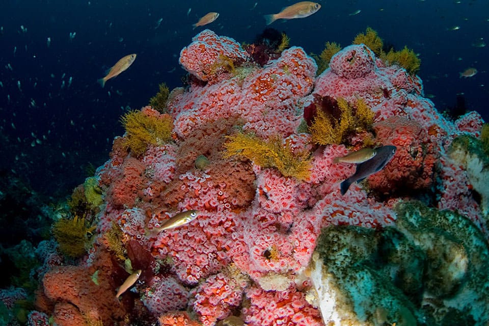
Seagrasses are plants that grow in semi salty water to full seawater in the intertidal and subtidal zones of the ocean. As one of the most productive ecosystems in the world, seagrasses offer myriad benefits to both humans and the organisms that call them home. In this episode, we explore some of the ecosystem services they offer.
seagrass.html>Episode%20permanent%20link,%20transcript,%20and%20show%20notes
%0A">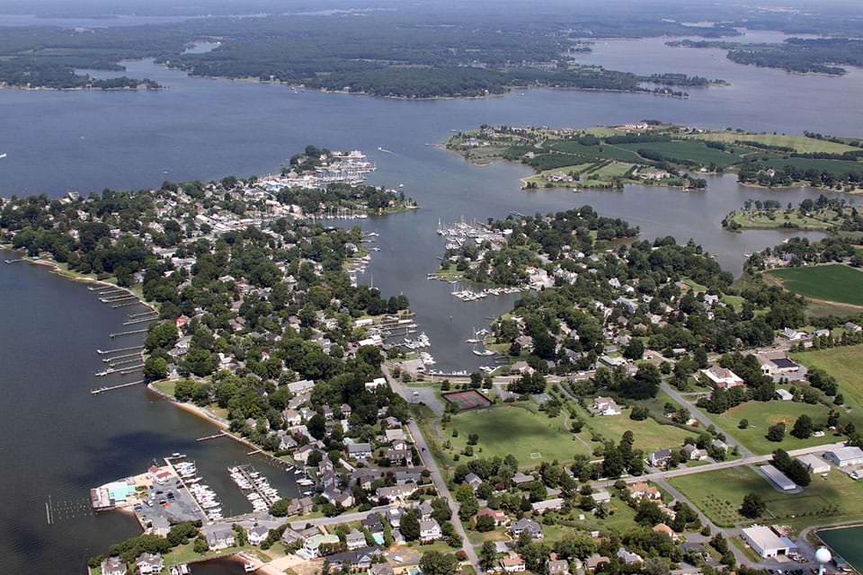
Our ocean and coasts affect us — and we affect them. Almost 40 percent of the country’s population lives in coastal shoreline counties. And these counties contribute more than 9 trillion dollars to the U.S. economy. But there are many challenges facing our coasts, like climate change, sea level rise, more intense storms, and population growth. So we need to make good decisions today to help our coasts continue to thrive tomorrow. This is the third podcast in a three-part series from the U.S. Global Change Research Program that explores how we make these decisions. In this episode, a panel of government experts share their unique perspectives and experiences regarding the science of coastal decision making, and how the future could look if effective decision making is adopted.
coastal-decision-making.html>Episode%20permanent%20link,%20transcript,%20and%20show%20notes
%0A">resilience-fund-960.jpg" alt="a New Jersey beach with a view of the New York City skyline">
Our ocean and coasts affect us — and we affect them. Almost 40 percent of the country’s population lives in coastal shoreline counties. And these counties contribute more than 9 trillion dollars to the U.S. economy. But there are many challenges facing our coasts, like climate change, sea level rise, more intense storms, and population growth. So we need to make good decisions today to help our coasts continue to thrive tomorrow. This is the second podcast in a three-part series from the U.S. Global Change Research Program that explores how we make these decisions. In this episode, we explore what the latest behavioral science research can tell us about how we make conservation and environmental decisions.
making-coastal-decisions.html">Episode permanent link, transcript, and show notes
equity960.jpg" alt="Volunteers plant natural grasses safely behind a newly constructed breakwater, which is part of a living shoreline project, at Camp Wilkes in Biloxi, Mississippi. The breakwater’s role is to reduce erosion on the shoreline by decreasing the wave energy and allowing plants to grow on the shore. (Mississippi-Alabama Sea Grant).">
Our ocean and coasts affect us — and we affect them. Almost 40 percent of the country’s population lives in coastal shoreline counties. And these counties contribute more than 9 trillion dollars to the U.S. economy. But there are many challenges facing our coasts, like climate change, sea level rise, more intense storms, and population growth. So we need to make good decisions today to help our coasts continue to thrive tomorrow. This is the first podcast in a three-part series from the U.S. Global Change Research Program that explores how we make these decisions. In this episode, hear an interview with coastal consultant Adam Parris on the topic of equity and justice in coastal planning.
equity-justice-coastal-planning.html">Episode permanent link, transcript, and show notes
oral-histories.jpg" alt="historical image of fishermen">
The NOAA Voices Oral History Archive is a collection of more than 2300 oral histories. In this episode, we explore how this valuable resource helps us better understand the impact of weather events, coastal changes and climate change.
oral-history-archive.html">Episode permanent link, transcript, and show notes
population-640.jpg" alt="The 2020 U.S. center of population is located in Hartville, Missouri. This location was determined by data collected from the latest U.S. census.">
For over six decades, the National Geodetic Survey has partnered with the U.S. Census Bureau to calculate the U.S. center of population — the precise location where an imaginary, flat, weightless, and rigid map of the United States would balance perfectly if all Americans were of identical weight. Tune in to the latest episode of the NOAA Ocean podcast to learn about the center of population, and how capturing snapshots of the U.S. population reveals long-term migration patterns and even helps us use maps on our smartphones.
center-population.html">Episode permanent link, transcript, and show notes
spined-sea-urchins.jpg" alt="An expert from NOAA’s Coral Reef Conservation Program discusses a disease affecting Long-spined sea urchin populations in the Caribbean.">
In this episode, an expert from NOAA’s Coral Reef Conservation Program discusses a disease affecting long-spined sea urchin populations in the Caribbean. We explore how disease has impacted these organisms in the past, their important role in keeping coral reef systems healthy, and how you can help save them.
long-spined-sea-urchins.html">Episode permanent link, transcript, and show notes
thomas-jefferson.jpg" alt="NOAA and NOAA contractors will be conducting multiple hydrographic mapping missions in the Great Lakes this summer aboard NOAA Ship Thomas Jefferson.">
Keeping our marine transportation system moving safely and efficiently through our busy national waterways depends upon hydrography — the science that measures and describes the physical features of bodies of water through a process called surveying. In this episode, hear how and why this work is done from two NOAA experts who talk about ongoing hydrographic survey missions within the Great Lakes.
surveying-great-lakes.html">Episode permanent link, transcript, and show notes
island-960.jpg" alt="Swan Island, Chesapeake Bay">
In this episode, we present a podcast from the U.S. Army Corps of Engineers called Engineering with Nature. Host Sarah Thorne and Todd Bridges, Senior Research Scientist for Environmental Science with the U.S. Army Corps of Engineers and the National Lead of the Engineering With Nature® program, are joined by Steve Thur, Director of NOAA's National Centers for Coastal Ocean Science. Sarah, Todd, and Steve discuss how the practice of Engineering With Nature and the application of nature-based solutions are evolving and the importance of protecting critical coastal ecosystems. They also tell the story of the collaboration and partnership between the Army Corps of Engineers and NOAA.
engineering-with-nature.html">Episode permanent link, transcript, and show notes
tsunami-kiptopeke-960.jpg" alt="Water level stations, like this one located at Kiptopeke, VA, provide observations that help the tsunami warning centers issue accurate tsunami alerts.">
Tsunamis pose a threat to our nation’s coastal communities and can have devastating impacts to lives and property. These powerful forces of nature can be caused by events like earthquakes, landslides, and even volcanic activity like the January 2022 eruption in the Tonga Islands region. Although they can’t be stopped, detecting and monitoring these waves when they occur can help warn the public of possible danger. In this episode, we speak with Paul Fanelli, Lead Oceanographer for NOAA’s National Ocean Service, Center for Operational Oceanographic Products and Services to learn how water level stations provide critical data to help issue alerts, and about the unique wave caused by the Tonga eruption.
ct-estuary-reserve.html">Episode permanent link, transcript, and show notes
reserve-960.jpg" alt="Image of the Connecticut Research Reserve.">
In this episode, we speak with Erica Seiden, manager for NOAA’s Ecosystems Program and the National Estuarine Research Reserve System; and Nelle D'Aversa, a NOAA coastal management specialist, to learn why this site was chosen and what this valuable ecosystem can teach us.
downtown-miami-960.jpg" alt="Minor coastal flooding during high tides in Miami FL">
In this episode, we talk with two members of the Federal Sea Level Rise Task Force about the new Sea Level Rise Technical Report, released in 2022. This landmark interagency report provides updated sea level rise projections based upon global warming amounts for the U.S. coastlines by decade to 2150, and provides data to assess current and changes in minor-to-major flood probabilities out to year 2050. The information is intended to inform coastal communities and others about the effects of current and future sea level rise to aid in decision making. sea-level-rise.html">Episode permanent link, transcript, and show notes
coast960.jpg" alt="Homer Alaska port with ships in dock">
In this podcast, we share a new series from the Alaska Ocean Acidification Network called The Future Ocean. It's about the effects of ocean acidification and ocean warming on coastal Alaskans and the seafood industry. However, you don’t need to live in our 50th state to listen: the themes featured in this series are global. Hear interviews with a number of experts talking about changing ocean conditions and what it means to put a price on carbon emissions as a tool to accelerate renewable energy infrastructure and drive down carbon emissions. futureocean.html">Episode permanent link, transcript, and show notes
restoration960.jpg" alt="juvenile chinook salmon">
When pollution harms our waterways from single events like oil spills or from industrial sites over a span of decades, the cleanup phase is just the beginning. Ultimately, through a process that can take years to decades, settlements are reached with the parties that caused the pollution to fund restoration projects. The goal: to put back what was lost. In this episode, learn how good things like restoration can come from bad things like oil spills and superfund sites.
restoration.html">Episode permanent link, transcript, and show notes
waters-and-boat-960.jpg" alt="Aerial view of Papahānaumokuākea Marine National Monument, the largest marine conservation area in the world">
From protecting kelp forests and corals to inspiring international collaboration with a common goal, Marine Protected Areas (MPAs) play a vital role in conserving our Earth’s special marine places. In this episode, we speak with Lauren Wenzel, director of NOAA’s National Marine Protected Areas Center, about the importance of MPAs, NOAA’s role in managing them, and what the future might look like for these special places.
mpa.html">Episode permanent link, transcript, and show notes
960.jpg" alt="A screenshot of the Chesapeake Bay Operational Forecast System 3D Water Temperature taken from the U.S. Integrated Ocean Observing System (IOOSⓇ) Model Viewer.">
What do harmful algal blooms, dust from the Saharan desert, and hurricanes have in common? They are all pieces of the puzzle that modeling puts together to give us the big picture when it comes to studying and understanding our ocean and coasts. In part two of this two-part episode, we continue our conversation with scientist Dr. Tracy Fanara about how modeling supports NOAA mission areas and supports coastal communities. We discuss how modeling helps these communities reduce risks to their lives and livelihoods, and how the National Ocean Service works to meet the evolving needs of those who are impacted.
48-modeling.html">Episode permanent link, transcript, and show notes
960.jpg" alt="A screenshot of the Chesapeake Bay Operational Forecast System 3D Water Temperature taken from the U.S. Integrated Ocean Observing System (IOOSⓇ) Model Viewer.">
What do harmful algal blooms, dust from the Saharan desert, and hurricanes have in common? They are all pieces of the puzzle that modeling puts together to give us the big picture when it comes to studying and understanding our ocean and coasts. In part one of this two-part episode, we take a deep dive into why modeling is important, what kind of data is provided and how collaboration with stakeholders strengthens our knowledge base.
48-modeling.html">Episode permanent link, transcript, and show notes
NOAA is moving into the digital age by phasing out paper nautical charts over five years. In this episode, we talk with NOAA Corps Capt. EJ Van Den Ameele, chief of Coast Survey's marine chart division, to learn how this transition will affect mariners and why electronic charts offer many advantages over paper. And if you still need paper charts, Coast Survey has you covered. EJ discusses how an online tool called NOAA Custom Chart makes it easy to export printable charts for all maritime areas.
custom-chart.html">Episode permanent link, transcript, and show notes
keys-dem-960.jpg" alt="lira image of Florida keys reefs">
Lidar stands for light detection and ranging. We explore how this popular remote sensing method supports NOAA’s mission and enables scientists and mapping professionals to examine both natural and manmade environments with accuracy, precision, and flexibility.
lidar.html">Episode permanent link, transcript, and show notes
today-Kurt-Mann960.jpg" alt="Kurt Mann holding a pro camera on the deck of the NOAA ship Ron Brown">
Let's dive into the ocean! NOAA Ocean Today offers more than three hundred exciting, scientifically vetted short videos on topics ranging from deep sea exploration to climate change to marine life. Visit Ocean Today online, participate in a monthly 'Full Moon' live online show, or visit one of the many Ocean Today interactive kiosks located in museums, aquaria, and zoos around the world. Kurt Mann, Ocean Today Executive Producer, joins us to tell us all about this program.
ocean-today.html">Episode permanent link, transcript, and show notes
Northeast Michigan’s Thunder Bay National Marine Sanctuary is estimated to contain over 200 shipwrecks. In this episode, we speak with sanctuary superintendent Jeff Gray about the significance of these world-class wrecks, the rich history they contain, and the wealth of scientific research and recreational opportunities that the sanctuary has to offer. We also dive into how NOAA, its partners, and the community of Alpena, Michigan, work together to advance the sanctuary’s mission of preservation, research, and recreation.
thunder-bay.html">Episode permanent link and show notes
Healthy coral reefs are amongst the most biologically diverse, culturally significant, and economically valuable ecosystems on Earth. In this episode, we speak with Lisa Vandiver, a Marine Habitat Restoration Specialist with NOAA’s Restoration Center and Rob Ferguson, a watershed management specialist with NOAA’s Coral Reef Conservation Program, to learn about how NOAA works alongside local partners on the island of Culebra to protect and restore the coral reef ecosystems and reduce the impacts of pollution.
culebra-coral-reef.html">Episode permanent link and show notes

NOAA's Precision Marine Navigation team is creating new online services to enable more efficient access to the NOAA data that powers private-sector marine navigation products. In this episode, Julia Powell and John Kelley from the Office of Coast Survey share how the team is working to foster innovation, improve navigation safety, aid in more efficient coastal route planning, and help mariners make informed decisions as they navigate our nation's waterways.
precision-marine-navigation.html">Episode permanent link and show notes
shelley-beau-microplastic-mussel960.jpg" alt="Left image: Kimani Kimbrough, NOAA physical scientist with the Mussel Watch program, recovers a mooring with caged mussels near the seawall at Jones Island wastewater treatment plant in Milwaukee, Wisconsin. Right image: Shelly Tomlinson, NOAA research oceanographer, and Beau Bramer, Northeast regional manager with NOAA's Great Lakes Environmental Research Laboratory, prepare to dive for mussels in Milwaukee Bay, Lake Michigan.">
In this episode, we continue our conversation with two NOAA scientists about a study that looked at using mussels as "biomonitors" to measure microplastic pollution in the Great Lakes. Here, they discuss how their study was set up and how the scientific method works. Amy and Ed also discuss how unexpected results are often part of the scientific process, and how conducting a study in the field with living organisms ist so challenging. This is part two of a two-part episode.
microplastic-mussels-part-two.html">Episode permanent link and show notes
ed-microplastic-mussel960.jpg" alt="Podcast guests Amy V. Uhrin, chief scientist for NOAA’s Marine Debris Program, and Ed Johnson, physical scientist with NOAA's Mussel Watch Program. Here, Amy and Ed are shown collecting samples of invasive zebra mussels on a research vessel in Lake Michigan.">
In this episode, we hear about a NOAA-funded study that asked an interesting question: what if mussels could be used to learn more about microplastic pollution in our waterways? NOAA already runs a program that monitors chemical contaminants in our coastal waterways and Great Lakes by sampling mussels and oysters called the Mussel Watch program. So wouldn’t it be great to tap into Mussel Watch to also learn more about plastics in our environment? Spoiler alert: the study didn’t turn out quite as expected. This is part one of a two-part episode.
microplastic-mussels-part-one.html">Episode permanent link and show notes
survey-ep38-960.jpg" alt="A diver amongst corals">
Coral reefs are among the most valuable ecosystems on Earth. Unfortunately, they are declining due to manmade and natural threats. NOAA’s National Coral Reef Monitoring Program (NCRMP) is a massive, collaborative effort that was developed to collect scientifically sound, geographically comprehensive biological, climate, and socioeconomic data in U.S. coral reef areas. In this episode, we speak with Shay Viehman, a Research Ecologist with NOAA’s National Ocean Service in the National Centers for Coastal Ocean Science, and a contributor to the NCRMP, to learn how NOAA divers turn the data they collect from underwater missions into usable summaries that help scientists study and protect U.S. coral reef ecosystems.
diving-corals.html">Episode permanent link and show notes
infrastructure960.jpg" alt="A beach with sand dunes and grasses">
Beach dunes, mangroves, wetlands, rain gardens, and bioswales are just a few examples of what experts call natural and nature-based infrastructure. In this episode, Kim Penn from NOAA’s Office for Coastal Management talks about how simple nature-based systems not only minimize coastal flooding, erosion, and runoff — but also form wonderful areas for recreation and tourism.
natural-infrastructure.html">Episode permanent link and show notes
troops960.jpg" alt="A landing craft on the way to Normandy during the Allied invasion, June 6, 1944. Credit: U.S. Army">
D-Day, codenamed Operation Neptune, was the largest amphibious landing not only in World War II, but in history. It marked the start of the liberation of German-occupied France (and later western Europe) and laid the foundations of the Allied victory on the Western Front. But what most people don't know is that ocean tides played a crucial role in the initial phase of this historic day. In this episode, hear the story of D-Day from the perspective of the science of tides and tide predictions. We interview Greg Dusek, a physical oceanographer and senior scientist at the Center for Operational Oceanographic Products and Services, or CO-OPS — the tides and currents office of the National Ocean Service.
dday-tides.html">Episode permanent link and show notes
The ocean is home to millions of different forms of life—yet we know surprisingly little about the creatures that live right along our shores, how they interact with each other, or how they're changing as the ocean environment they live in changes. Hear how the U.S. Marine Biodiversity Observation Network aims to change that. The goal is to ensure that scientists not only notice changes in biodiversity at locations around the nation, but also have the tools in place to better understand what these changes tell us about ocean health over time.
mbon.html">Episode permanent link and show notes
Discover the many free lesson plans, tutorials, fun activities, and other educational material offered by the National Ocean Service for educators, for students, for parents — or for anyone who wants to learn about our ocean and coasts.
resources.html">Episode permanent link and show notes
The National Geodetic survey has been measuring land to determine points on the ground and the angles, distances, and heights between them since the 1800s. To do this accurately, you have to understand the force of gravity. We talk with a NOAA geodesist to understand what gravity is, why and how it changes, and what it means for NOAA.
bluecarbon.jpg" alt="A graduate student at the Waquoit Bay National Estuarine Research Reserve documents information gathered from a chamber set up to measure carbon dioxide and methane exchange within the marsh.">
Money does not grow on trees, but it could be growing in our coastal salt marshes and sea grass beds. A team of researchers is working at Waquoit Bay Research Reserve on Cape Cod in Massachusetts on the Bringing Wetlands to Market project to study the connections between coastal wetlands, carbon dioxide uptake and storage, and the global carbon trading economy. Wetlands have the potential to serve as valuable assets in carbon trading markets – but only if we protect them, and don't dig up the treasure!
blue-carbon.html">Episode permanent link and show notes
nurdle-960.jpg" alt="Jace Tunnell, Director of the Mission Aransas National Estuarine Research Reserve, holds a nurdle in his hand. Photo Credit: Jace Tunnell.">
Nurdles are small plastic pellets that are causing a big problem. But citizen scientists are fighting back. In this episode, we talk with Jace Tunnell, Director of the Mission Aransas National Estuarine Research Reserve, about how the Nurdle Patrol is taking on these problematic pellets, and how you can get involved.
Editor's Note: The National Estuarine Research Reserve System is a network of 29 coastal sites designated to protect and study estuarine systems. NOAA provides funding and guidance to Mission Aransas National Estuarine Research Reserve, and the site is managed by the University of Texas Marine Science Institute. The Nurdle Patrol, which is run by Mission Aransas National Estuarine Research Reserve, is not directly affiliated with NOAA.
patrol.html">Episode permanent link and show notes
help-youngstown-fl-1200.jpg" alt="NOAA aerial imagery from Youngstown, Florida, showing a “help” sign made out of trees. A Florida family awaiting assistance after Hurricane Michael was discovered after the sign was photographed by a National Geodetic Survey aerial team and then viewed by a family member.">
Since the early 1900’s the National Geodetic Survey has been taking photographs from airplanes to capture the Earth below. We talk with two NOAA experts about their role in emergency response imagery collection after hurricanes, and what it provides for the public.
survey.html">Episode permanent link and show notes
phrases1200.jpg" alt="Print shows congestion of horse-drawn carts and wagons overburdened with merchandise on Dock Street, also handcarts, teamsters and longshoremen, and railroad locomotives and cars for hauling goods from ships to markets, includes many wholesale buildings and a transportation terminal, and the masts of many ships docked along the waterfront.">
Did you know many phrases that we use today have nautical origins? Lots of these terms derive from the Age of Sail — the period of time between the 16th and 19th centuries when masted ships ruled the seas.
phrases.html">Episode permanent link and show notes
keywest960.jpg" alt="Destruction in Key West, Florida, following Hurricane Irma in September 2017. (Credit: U.S. Coast Guard)">
In this episode, Kate Wheelock, Chief of NOAA’s Disaster Preparedness Program, explains how her team facilitates internal communication, coordination, and preparation for all types of unforeseen disasters.
Meteotsunamis occur all over the world — including the Great Lakes — but scientists are just beginning to better detect and understand them. In this episode, NOAA oceanographer Greg Dusek talks about new research that advances what we know about these little known, but surprisingly common, weather-driven events.
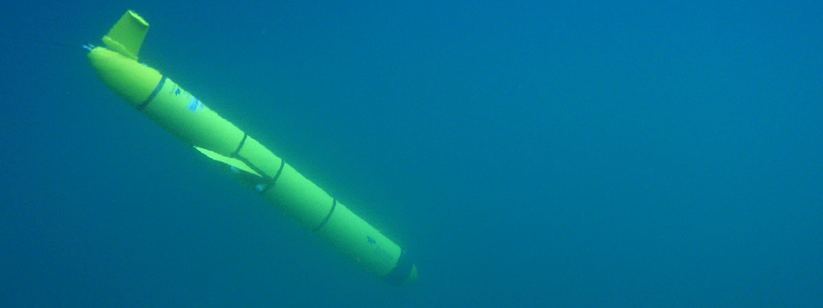
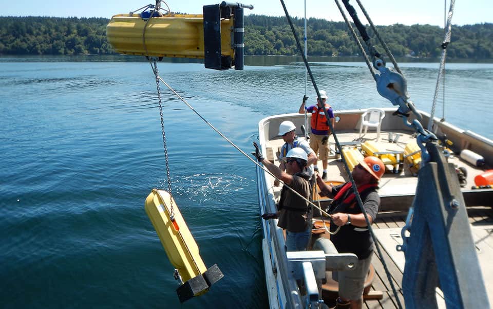
We interview a NOAA expert about ocean gliders — autonomous underwater vehicles used to collect valuable ocean data. In this episode, we uncover the technology behind gliders and dive in to what these vehicles can do to help prepare us for hurricanes.
gliders.html">Episode permanent link and show notes
1200.jpg" alt="View of a man navigating a ship from the bridge.">
In our latest podcast, Allison Wittrock, a cartographer with the Office of Coast Survey, tells us about NOAA’s new digital charts.
chart-going-digital.html">Episode permanent link and show notes
count960.jpg" alt="Mother and calf humpback whale pair swimming in Hawaiian waters. Hawaii is the only state in the U.S. where humpback whales go to breed, mate, and nurse their young.">
In this episode, Cindy Among-Serrao from Hawaiian Islands Humpback Whale National Marine Sanctuary talks about how citizen scientists help monitor and promote awareness about marine life — particularly humpback whales — during the annual Sanctuary Ocean Count.
sanctuary-ocean-count.html">Episode permanent link and show notes
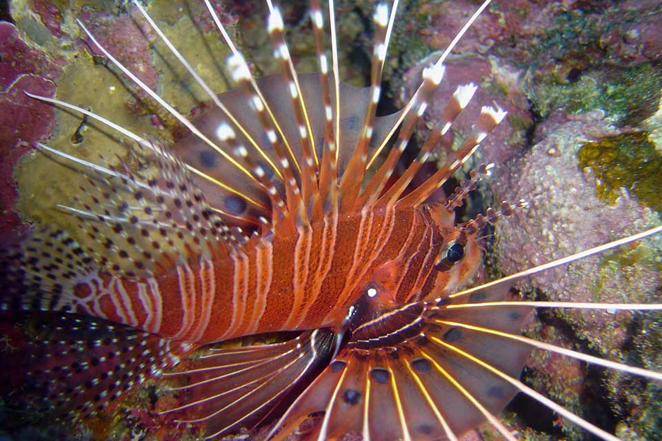
In this episode, a NOAA ecologist discusses how invasive lionfish have become established across the Southeast U.S. and Caribbean. How did the fish get to the Atlantic? While the exact cause is unknown, it's likely that humans provided a helping hand. While NOAA researchers have concluded that invasive lionfish populations will continue to grow and cannot be eliminated using conventional methods, efforts continue to control populations.
invasive-lionfish.html">Episode permanent link and show notes
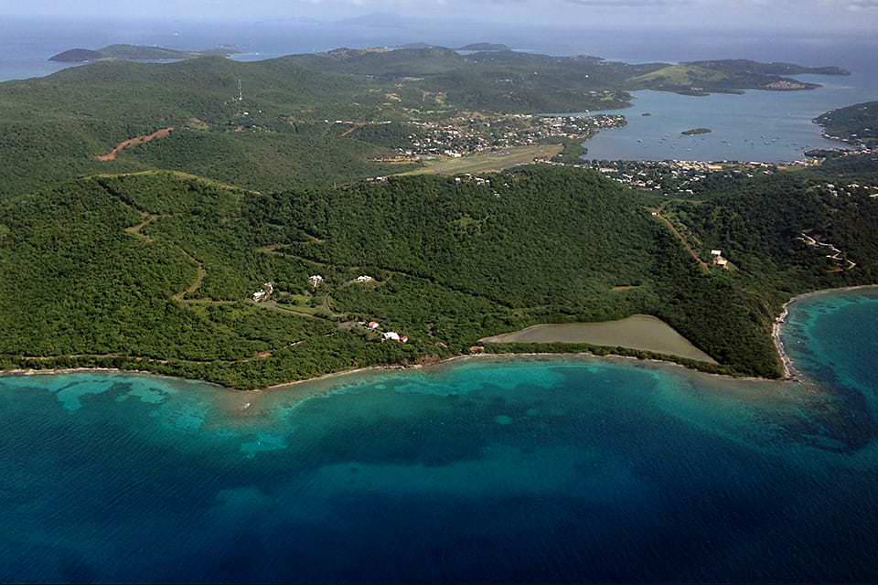
hattori960.jpg" alt="Hideyo Hattori on American Samoa">
This is the first half of a two-part interview with NOAA’s Hideyo Hattori. In this episode, we talk about the many ways that American Samoa is an amazing place, unlike anywhere else in the United States.
american-samoa.html">Episode permanent link and show notes
samoa960.jpg" alt="A coral head inside the protected lagoon at Rose Atoll. This protected area makes a great habitat for small fish to grow. (Photo: NOAA Fisheries/Louise Giuseffi)">
This is the second part of our interview with NOAA’s Hideyo Hattori about American Samoa. In this episode, we focus on Hideyo’s work with conserving the bountiful corals that surround the islands of this remote archipelago.
american-samoa.html">Episode permanent link and show notes
podcast1200.jpg" alt="a green harmful algal bloom on Lake Erie in 2017">
Harmful algal blooms (HABS) ... it's a term that many people became familiar with in 2018 due to a persistent "red tide" event along the Gulf Coast of Florida. In this podcast, we uncover what HABS are, what they aren’t, and how we can learn to minimize their effects on our daily lives.
harmful-algal-blooms.html">Episode permanent link and show notes
systems1200.jpg" alt="Bathymetric Explorer and Navigator (BEN) Unmanned Surface Vehicle (USV) underway from the NOAA Ship Fairweather off Point Hope, Alaska, July, 2018. BEN, a four-meter diesel-powered USV manufactured by ASV Global, has an endurance of over 16 hours and is equipped with a standard suite of hydrographic survey equipment.">
With the use of unmanned systems, NOAA is reducing operational costs and manpower requirements, while increasing the type and quality of data that NOAA collects. In this episode, Rob Downs from NOAA’s Office of Coast Survey explains the past, present, and possible future of unmanned systems at NOAA.
unmanned-systems.html">Episode permanent link and show notes
noise.jpg" alt="The level of noise pollution in the oceans has increased dramatically the last 50 years. As shipping traffic increases and ships get bigger and noisier, ocean noise is becoming a larger issue within NOAA's sanctuaries. Shown here: Whales swimming near a tanker, photo taken under NOAA Fisheries Permit # 981-1707-00.">
Many marine organisms, including marine mammals, sea turtles, fish and invertebrates, rely on sound and hearing for their survival. Over the last century, increases in human activity within our ocean have led to increasing levels of noise. This increasing amount of noise from human sources is a rising concern for the health and well-being of marine organisms and ecosystems. In this episode, we talk with NOAA marine ecologist Dr. Leila Hatch about her work to better understand the ocean soundscape by developing programs that can establish baselines, detect changes in noise levels, and support the design of methods to reduce noise impacts.
ocean-noise.html">Episode permanent link and show notes
shoreline.jpg" alt="This aerial photo shows the Mississippi coast with a living shoreline project that includes both natural infrastructure and artificial breakwater material to reduce shoreline erosion. e">
Natural infrastructure provides effective solutions for minimizing coastal flooding, erosion, and runoff, but it has other benefits as well. In this episode, Kim Penn from NOAA’s Office for Coastal Management explains the environmental, economic, and recreational benefits of natural infrastructure.
natural-infrastructure.html">Episode permanent link and show notes
response.jpg" alt="Hurricane Irma from space">
June 1 is the start of the Atlantic hurricane season. Are you prepared? To help, learn the many ways the National Ocean Service responds to hurricanes, as well as easy steps you can take to be ready for whatever the season brings.
nos-hurricanes.html">Episode permanent link and show notes
currents.jpg" alt="This NASA visualization shows the Gulf Stream stretching from the Gulf of Mexico all the way over towards Western Europe. The ocean flows are colored to show sea surface temperature data.">
Understanding how the ocean moves is no easy task. In this episode, we hear from a NOAA oceanographer who studies the physics of how the ocean moves to better understand and predict how tides and currents shape our coastal environment.
tides-currents.html">Episode permanent link and show notes
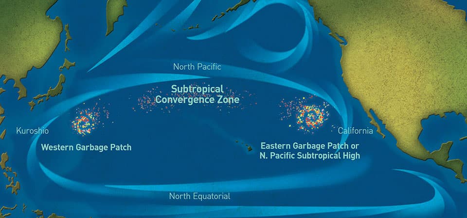
How the gyres that circulate our ocean waters also accumulate plastics. Find out what a garbage patch is and isn't, and what we can do about this ocean-sized problem.
ocean-garbage-patches.html">Episode permanent link and show notes
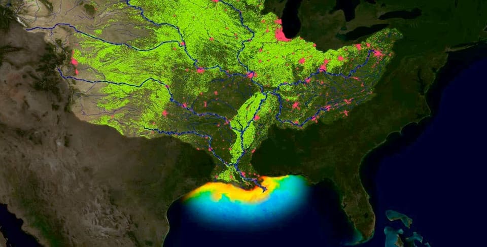
When water runs off of farmland and urban centers and flows into our streams and rivers, it is often chock-full of fertilizers and other nutrients. These massive loads of nutrients eventually end up in our coastal ocean, fueling a chain of events that can lead to hypoxic "dead zones" — areas along the sea floor where oxygen is so low it can no longer sustain marine life. In this episode, we're joined by NOAA scientist Alan Lewitus to explore why dead zones form, how the problem of hypoxia is growing worse, and what we're doing about it.
hypoxia.html">Episode permanent link and show notes
Geodesy is a science that covers the Earth itself. It's the reason we know where we are, and how we can make maps of where we are and where we want to go. In this episode, learn how this science with an unfamiliar name shapes much of what we do every day.
geodesy.html">Episode permanent link and show notes
marinedebris1.jpg" alt="This vessel, the F/V Ocean Clipper went aground on Alaska's St. Paul Island in the late 1980s.">
In celebration of Native American Heritage Month, our latest podcast highlights NOAA efforts in partnership with native communities in Alaska to restore and protect precious ocean resources. In this episode, we learn just how challenging the issue of marine debris can be in the vast wilderness of Alaska, how the NOAA Marine Debris program is working to solve this problem, and how the key to beating this issue is in the innovation and ingenuity of the community working to address it.
alaska-marine-debris.html">Episode permanent link and show notes
reef-resilience.jpg" alt="a coral reef">
It's time for a NOAA Ocean Podcast "Science Moment," where we sample the best segments from our past full-length podcasts. In this episode, learn about how coral reefs respond to stressful events like coral bleaching.
reef-resilience.html">Episode permanent link and show notes
Do you know the difference between a tide, a current, and a tidal current? Why (and how) do we study the motion of the ocean?
current-surveys.html">Episode permanent link and show notes
It's time for a NOAA Ocean Podcast "Science Moment," where we sample the best segments from our past full-length podcasts. In this episode, learn about NOAA's historical map and chart collection of more than 35,000 scanned images.
historical-maps-charts.html">Episode permanent link and show notes
In our latest episode, we explore the history and work of NOAA's Commissioned Officer Corps--one of the seven uniformed services of the United States. NOAA Corps officers command NOAA's fleet of research and survey ships and also pilot NOAA's environmental data-gathering aircraft, including the agency's hurricane hunter planes. The NOAA Corps is celebrating a century of service to the nation this year, 2017.
noaa-corps.html">Episode permanent link and show notes
It's time for a NOAA Ocean Podcast "Science Moment," where we sample the best segments from our past full-length podcasts. In this episode, learn about marine animal telemetry, used to help scientist understand the ocean and marine life better.
animal-telemetry.html">Episode permanent link and show notes
In today's NOAA Ocean Podcast, we talk about moving towards restoration at industrial waste sites. For more than a century, industrial activities have released hazardous chemicals and heavy metals into the environment. Both accidental spills and intentional discharges from chemical manufacturing, oil storage and transfer, ship building, and port operations have contaminated many of America's rivers and coastal resources. Join us as we talk with Reyhan Mehran from NOAA's Office of Response and Restoration about this topic.
restoration.html">Episode permanent link and show notes
It's time for a NOAA Ocean Podcast "Science Moment," where we sample the best segments from our past full-length podcasts. In this episode, hear about volunteering opportunities at one of our national marine sanctuary sites around the nation.
sanctuary-vounteer.html">Episode permanent link and show notes
It's time for a NOAA Ocean Podcast "Science Moment," where we sample the best segments from our past full-length podcasts. In this episode, hear about an effort called GPS on Bench Marks. A bench mark is a term used to describe any permanent mark or disk that's either in the ground or attached to a large structure. This permanent mark has a known elevation or height which makes it valuable to NOAA. There are over 400,000 bench marks in the United States, and in the GPS on Bench Marks project, anyone can visit the bench mark of their choice, record field notes, take digital photos, and collect GPS observations or coordinates and then use online tools to send the information to NOAA.
gps-benchmarks.html">Episode permanent link and show notes
How NOAA scientists use marine biogeography—the study of marine species, the geographic distribution of their habitats, and the relationships between living organisms and the environment—to help locate the best sites to place potential future alternative energy sites in the ocean.
wind-energy.html">Episode permanent link and show notes
The ocean is home to millions of different forms of life—yet we know surprisingly little about the creatures that live right along our shores, how they interact with each other, or how they're changing as the ocean environment they live in changes. Hear how the U.S. Marine Biodiversity Observation Network aims to change that. The goal is to ensure that scientists not only notice changes in biodiversity at locations around the nation, but also have the tools in place to better understand what these changes tell us about ocean health over time.
mbon.html">Episode permanent link and show notes
What is ocean noise and what is NOAA doing to reduce this threat in our national marine sanctuaries? Many marine organisms, including marine mammals, sea turtles, fish and invertebrates, rely on sound and hearing for their survival. Over the last century, increases in human activity within our ocean have led to increasing levels of noise. This increasing amount of noise from human sources is a rising concern for the health and well-being of marine organisms and ecosystems. In this episode, we talk with NOAA marine ecologist Dr. Leila Hatch about her work to better understand the ocean soundscape by developing programs that can establish baselines, detect changes in noise levels, and support the design of methods to reduce noise impacts.
ocean-noise.html">Episode permanent link and show notes
Listen in as we talk about coral reef health, specifically how reefs respond to stressful events like coral bleaching.
reef-resilience.html">Episode permanent link and show notes
Coral reefs are under intense pressure from climate change, pollution, and unsustainable use. So what can we do about it? To answer that question, we need to better understand the main threat to our reefs. Humans. Tune in to this excerpt from a longer interview we posted back in March 2016 with NOAA social scientists Maria Dillard and Peter Edwards.
corals-humans.html">Episode permanent link and show notes
In this episode, we talk with a NOAA economist about our ocean economy and how, no matter where you live in the United States, you are connected to our ocean economy.
oceaneconomy.html">Episode permanent link and show notes
Money does not grow on trees, but it could be growing in our coastal salt marshes and sea grass beds. A team of researchers is working at Waquoit Bay Research Reserve on Cape Cod in Massachusetts on the "Bringing Wetlands to Market" project to study the connections between coastal wetlands, carbon dioxide uptake and storage, and the global carbon trading economy. Wetlands have the potential to serve as valuable assets in carbon trading markets – but only if we protect them, and don't dig up the treasure!
wetlands-bluecarbon.html">Episode permanent link and show notes
In this episode, we talk with a NOAA expert about how (and why) we forecast harmful algal blooms.
hab-forecast.html">Episode permanent link and show notes
One hundred and four years ago this month, the RMS Titanic sank after striking an iceberg on her maiden voyage from the United Kingdom to New York City. In recognition of this tragedy, we present an interview with Jim Delgado, Director of Maritime Heritage with NOS's Office of National Marine Sanctuaries. This podcast is an excerpt from a special two-part podcast published in 2012.
titanic.html">Episode permanent link and show notes
Coral reefs are under intense pressure from climate change, pollution, and unsustainable use. So what can we do about it? To answer that question, we need to better understand the main threat to our reefs. Humans.
coral-human-connection.html">Episode permanent link and show notes
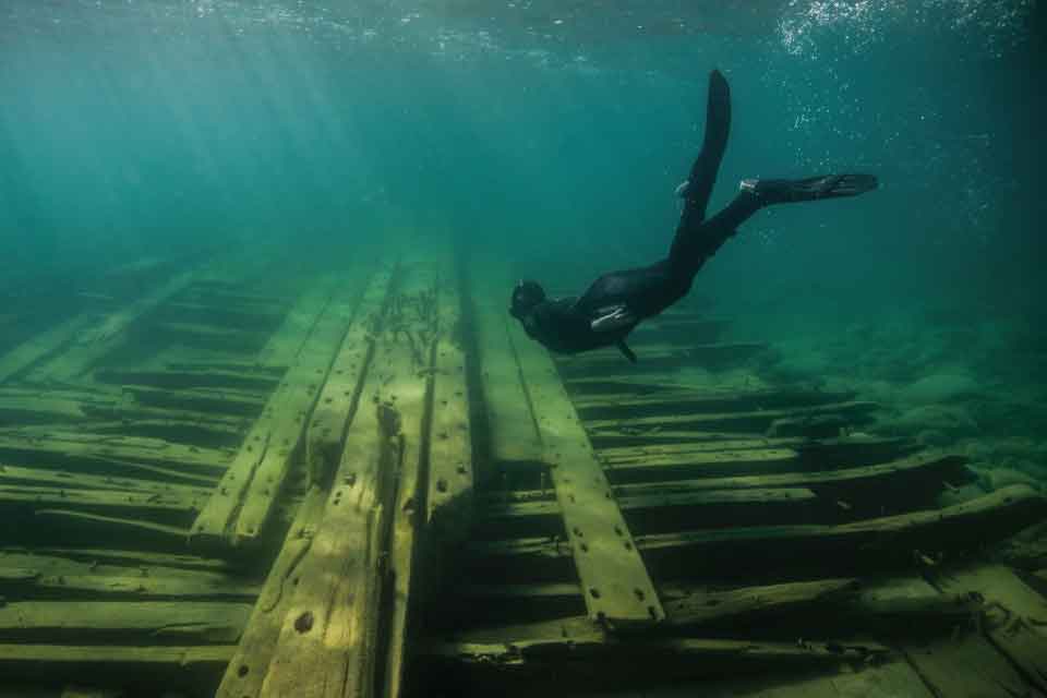
In this episode, we look back at a November 2014 archaeological expedition led by the Office of National Marine Sanctuaries Maritime Heritage Program. This mission brought back the first-ever 3-D images of the City of Rio de Janeiro, considered by many historians as the "Titanic of the Golden Gate." Listen in to this conversation with NOAA's Robert Schwemmer, co-leader of a two-year study to locate and document shipwrecks in California’s Gulf of the Farallones National Marine Sanctuary and the surrounding area.
shipwreck-detective.html">Episode permanent link and show notes
Alaska—the largest and most remote state in the United States—is filled with wilderness and beauty, and unfortunately with marine debris. With a longer coastline than all the other U.S. states combined, Alaska finds itself with the greatest concentration of marine debris in our country. In this episode, we learn just how challenging the issue of marine debris can be in the vast wilderness of this state, how the NOAA Marine Debris program is working to solve this problem, and how the key to beating this issue is in the innovation and ingenuity of the community working to address it.
alaska-marine-debris.html">Episode permanent link and show notes
Have four minutes? Dive into our latest Ocean Shorts audio podcast as we explore what an invasive species is and how they are introduced to an area.
invasives.html">Episode permanent link and show notes
Dive into our latest Ocean Shorts podcast as we explore how marine debris moves in our environment and what causes it to move.
marinedebris.html">Episode permanent link and show notes
An effort to restore eelgrass beds along Virginia's eastern shore began with people painstakingly planting 200 acres of eelgrass seeds by hand. Today, these eelgrass meadows have grown to 6,195 acres — providing a home for an estimated 240,000 bay scallops!
eelgrass.html">Episode permanent link and show notes
Scientists at the National Institute of Standards and Technology, or NIST, are developing atomic clocks that are so accurate that the effects of the general theory of relativity come into play. That means if two of these clocks are at slightly different elevations—even a few centimeters—the higher clock runs noticeably faster. In this episode, find out why this is a problem for NIST, how the National Geodetic Survey helped to solve this problem, and how these amazing atomic clocks may someday play an important role in the science of geodesy. atomic-clocks.html">Episode permanent link and show notes
What does it mean when a coral bleaches? Hear from NOAA's Jennifer Koss and Mark Eakin on the effects of coral bleaching in our latest Ocean Shorts audio podcast.
bleaching.html">Episode permanent link and show notes
In this episode, hear about a condition known as hypoxia -- where oxygen levels drop so low that creatures in the water are stressed or killed.
hypoxia.html">Episode permanent link and show notes
Join us for an interview with oceanographer Tim Battista about mapping coral reef ecosystems in the U.S. Caribbean.
coral-mapping.html">Episode permanent link and show notesA NOAA "shipwreck detective" talks about a two-year study to locate and document shipwrecks in Gulf of the Farallones National Marine Sanctuary and the surrounding area.
shipwreck-detectives.html">Episode permanent link and show notesThis podcast could use a review! Have anything to say about it? Share your thoughts using the button below.
Submit Review


